


Three more feral pigs collared at Mt Hutton
Posted on February 1st, 2022
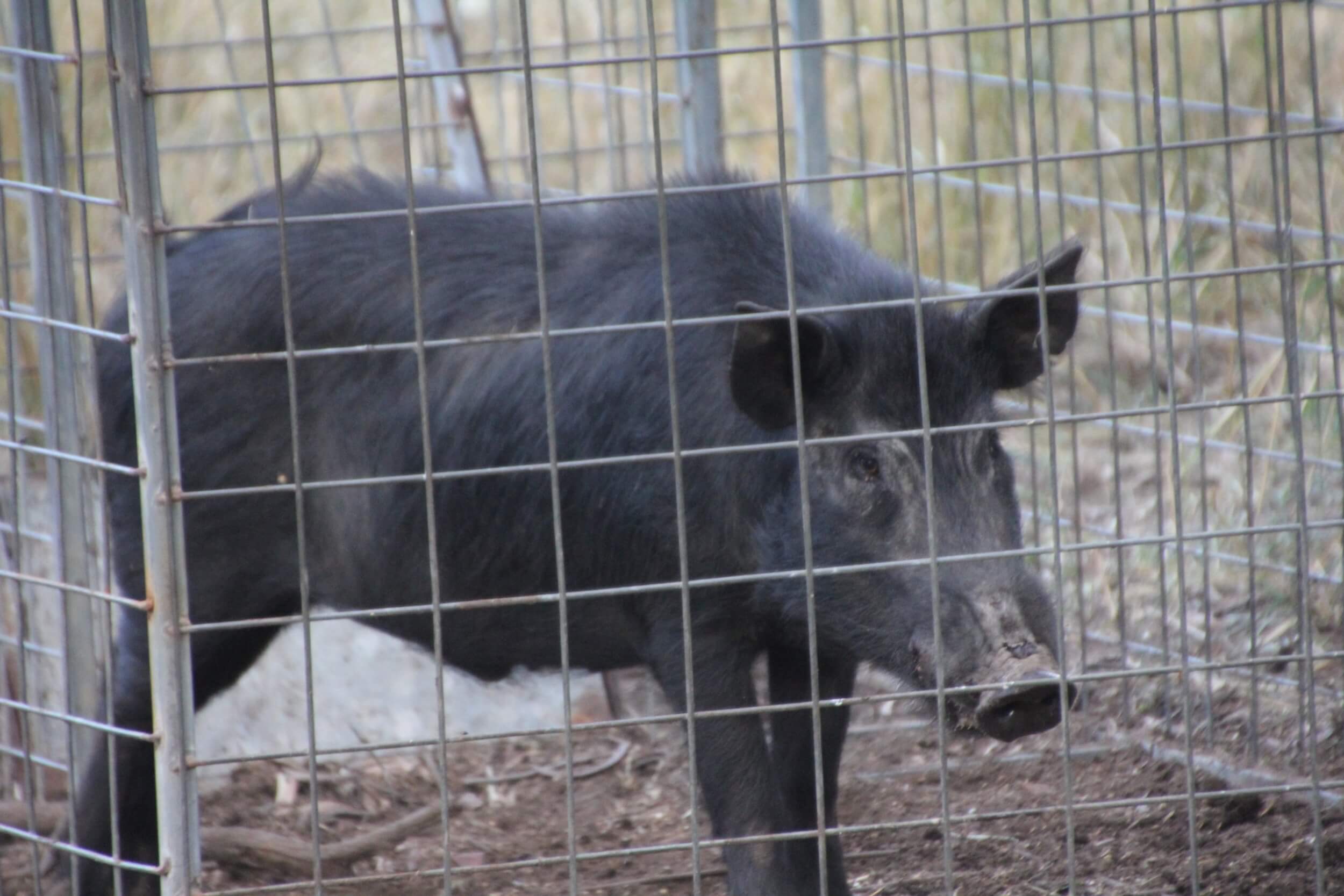
Fitzroy Basin Association (FBA) have been working with Southern Queensland Landscapes (SQL) and Mt Hutton land managers to trap and collar feral pigs in a bid to help reveal patterns in their movements.

Mt Hutton has the largest proportion of remnant Semi-evergreen vine thicket in Queensland that requires protection from biosecurity threats such as feral pigs.
Traditional methods such as aerial shooting were trialled first, but they didn’t provide effective long term results. It was decided to collect further data on feral pig habits using GPS collars to monitor patterns in activity and movement which would, in turn, inform the development of new more effective management strategies.
Trapping efforts are continuing across rural properties and land manager enthusiasm is strong. Coordinating time, effort and resources requires extensive planning and labour input to manage the daily pre-feeding and checking of pig traps at specific times and places on several properties.
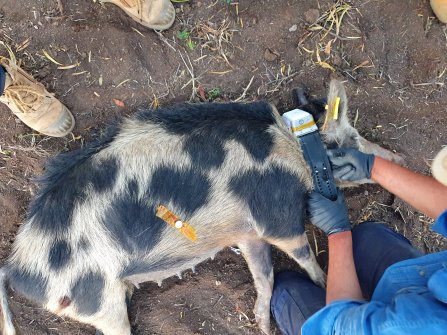
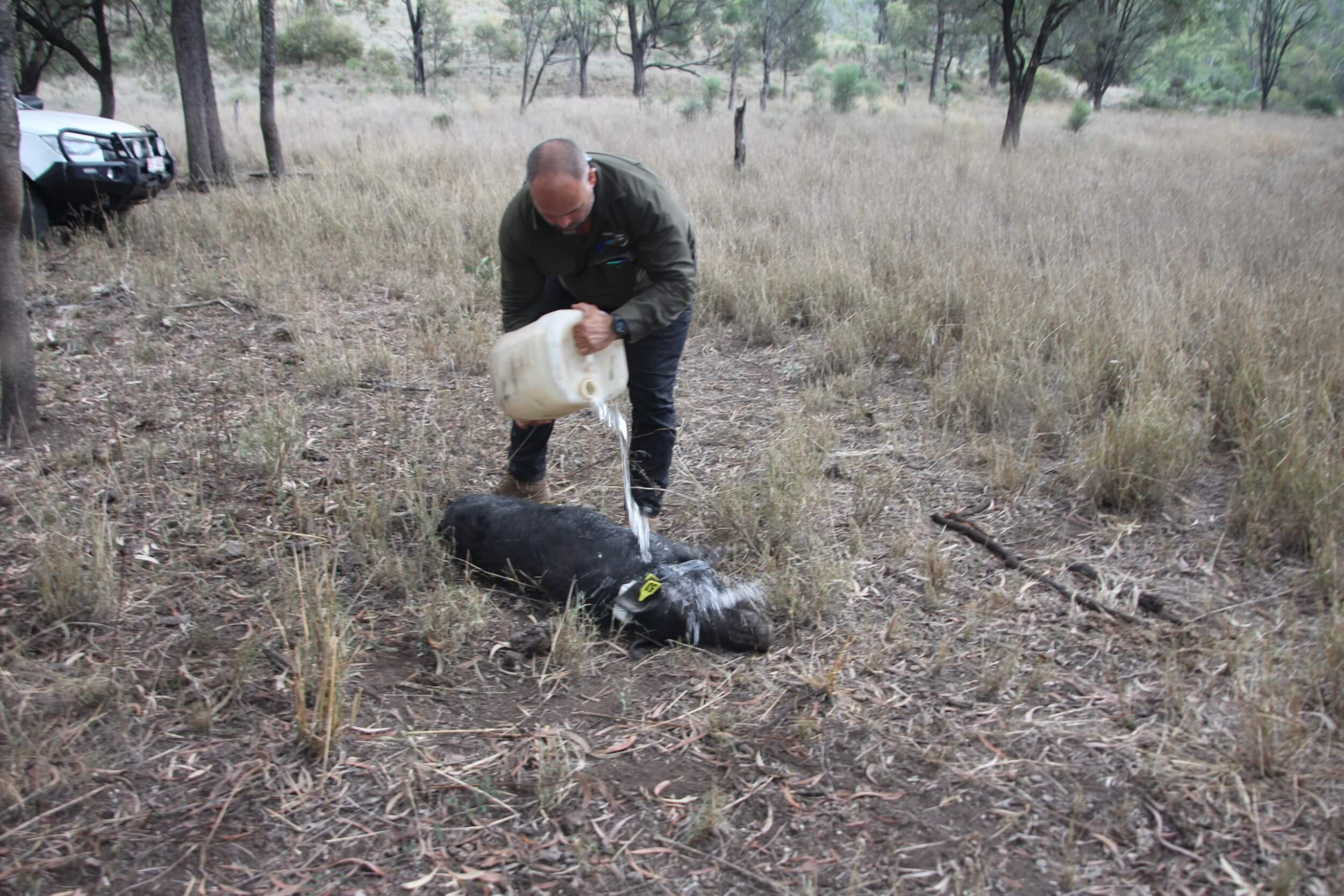
An additional three pigs were recently collared, and their movements tracked. With more information on pig movements, baits can be placed more effectively within their regular travel routes and trails.
Among the newly collared pigs was a very large 81kg boar, the biggest to be trapped so far in this Mt Hutton program.
Distinct patterns are being noticed with the males travelling much longer distances and in more directions across the properties than females. Hotspots of activity are becoming apparent where multiple pigs are visiting and being sighted.
FBA Project Officer (Environment), Hannah Kaluzynski said it is important to gather information on feral pig movements in their habitat.
“Feral pigs don’t respect parks, boundaries or farm fence lines. Their home territory range can span multiple properties, making use of trails, shelter, feeding and watering areas wherever it suits them.
“We based our management method choices on a shared understanding of local feral pig behaviour, their social structure, habitat and feeding preferences. This information gathered by collaring then informs our strategies for efficient control,”
Hannah Kaluzynski
Feral pig movements indicated by GPS data from the collars is communicated to contractors responsible for locating and managing the animal’s removal. Knowledge of biology and ecology inform timing of eradication methods to suit seasonal and daily peak activity periods.
This information is also shared with land managers who in turn provide local knowledge about personal observations of feral pigs on their properties to improve productivity and timing of control methods.
FBA and SQL hope to collar another five pigs to provide a more accurate representation of pig movement and activity across the area.