Second Reef Report Card released
Posted on April 22nd, 2013
The Reef Plan Second Report Card, which shows encouraging progress towards targets to improve water quality in the Great Barrier Reef, was released in early 2013 by the Australian and Queensland Governments. Download Report Card from the Reef Water Quality Protection Plan website.
It shows evidence of pollutant loads reducing as a result of management changes, suggesting that the short term Reef Plan goal to halt and reverse the decline in water quality in the Great Barrier Reef is being achieved.
FBA projects contribute to Reef Plan
Fitzroy Basin Association contributed to Reef Plan reporting through our work with farmers and graziers, as well as our involvement in the Paddock to Reef program funded by the Reef Rescue component of the Australian Government’s Caring for our Country. FBA manages projects looking at:
- Grazing management for riparian zones
- Paddock scale monitoring of run-off from cropping and grazing
- Monitoring of water quality from multi-farm sites
- Economic modelling of grazing systems in the Fitzroy and Burdekin catchments
- A detailed assessment of management practice changes within the Orion catchment
In addition catchment scale monitoring is being undertaken at Gordonstone, Brigalow and Spotswood catchments. This work is carried out in partnership with landholders, and organisations including CSIRO , and the Queensland Government through the Department of Environment and Resource Management and the Department of Employment, Economic Development and Innovation.
Project in focus: Cattle in Collars
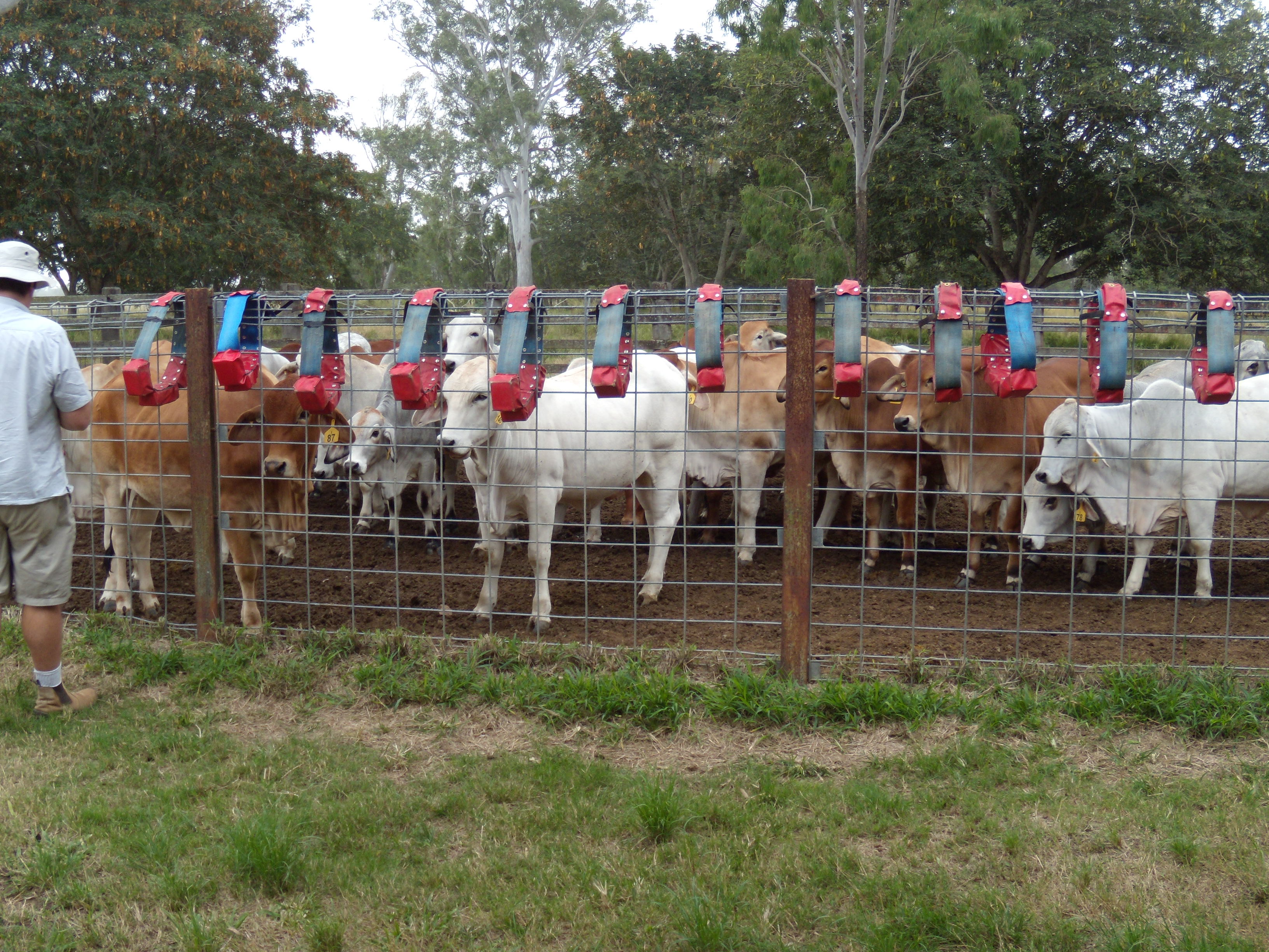
An excellent example of Paddock to Reef research is the cattle in collars project – watch the video here.
Fitzroy Basin Association worked with landholders, CSIRO, Central Queensland University, and the Department of Environment and Resource Management.
The project involved:
- Using GPS technology to provide insights into cattle movement and behaviour with each other and their environment, in particular riparian areas.
- Helping to test the theory that off-stream watering points near riparian zones reduce cattle access to creeks and consequent impacts on water quality, without the use of fences.
- Four beef properties within Fitzroy Basin chosen to participate in trial work. Field staff assessed the starting condition of riparian areas, pasture and ground cover levels.
- Around six beasts per property fitted with GPS tracking collars that transmit data every second.
- GPS data will be compiled to create a map showing behaviours such as how the herd accesses water and areas of preferred grazing.
- Results will feed into management advice and incentives offered by FBA.
- Future potential to pair GPS tracking technology with cattle control technology to create opportunities for active herd management.


