


Resources library
Resources
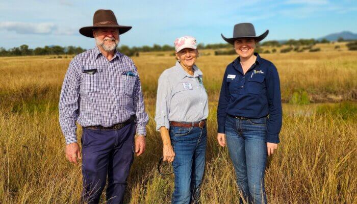
Case study – one-on-one property visit leaves a large legacy
Offmore Farm Case Study
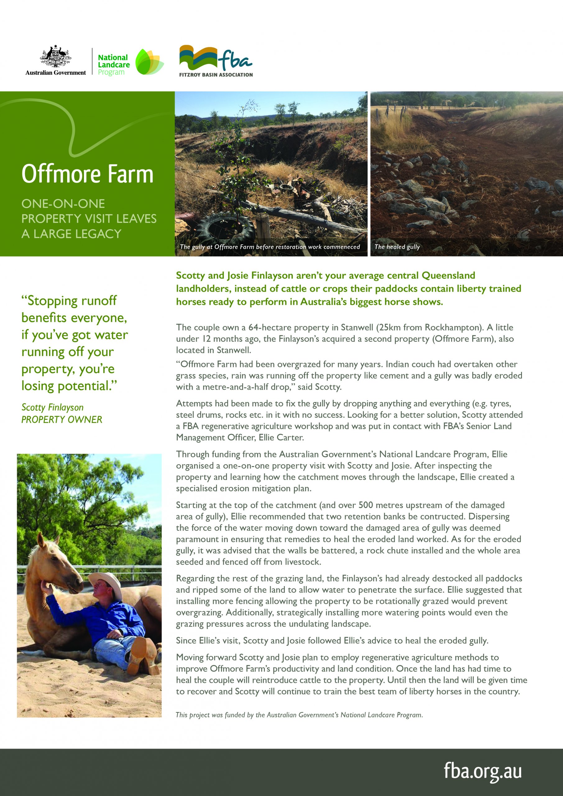
Scotty and Josie Finlayson aren't your average central Queensland landholders, instead of cattle or crops their paddocks contain liberty trained horses ready to perform in Australia's biggest shows. Through funding from the Australian Government's National Landcare Program, Senior FBA Land Management Officer, Ellie Carter, organised a one-on-one property visit to help the Finlayson's improve the condition of their newly acquired property.
28/07/2020
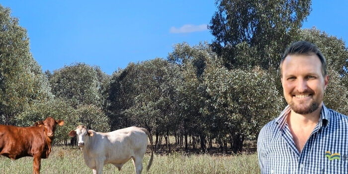
The benefits of canopy cover in grazing enterprises
Trees - the root of productivity
Native trees in grazing paddocks are providing central Queensland landholders with a variety of benefits. Keeping a 30% to 40% canopy cover on grazing land is helping local graziers improve their productivity and land condition. This flyer illustrates a few of the many benefits that native trees provide.
15/06/2020
Fitzroy Region – Understand Your Flood Risk
Fitzroy Regional Resilience Strategy
Learn about the Fitzroy Basin in Central Queensland and understand your flood risk. The Fitzroy Basin includes eleven catchments, with their creeks and rivers flowing into the Fitzroy River and its estuaries eventually flowing out to the Great Barrier Reef. The Queensland Government has partnered with six councils to deliver the Fitzroy Regional Resilience Strategy, which uses a collaborative catchment approach for best practice management of flood warning infrastructure. The purpose of the Strategy is to provide a consistent and coordinated approach to manage flood warning infrastructure throughout the region that will enhance community safety and resilience. The Strategy has been developed in consultation with Central Queensland Regional Organisation of Councils (CQROC); Banana Shire Council; Central Highlands Regional Council; Isaac Regional Council; Livingstone Shire Council; Rockhampton Regional Council; Woorabinda Aboriginal Shire Council; with input from supporting stakeholder agencies including the Bureau of Meteorology, Fitzroy Basin Association and SunWater.
29/04/2020
Improving soil health with Nicole Masters
Soils for Success Workshop Summary
To help central Queensland growers and graziers improve their soil health, FBA brought the internationally acclaimed soil expert Nicole Masters to the region. Nicole Masters is an independent agroecologist, systems thinker and educator. With over 20 years’ experience, she is a knowledgeable and dynamic speaker on the topic of soil health. Watch this video to learn more about Nicole and the workshop. If you want to know more about improving soils health read our blog or get in contact with one of our Land Management Officers (07 4999 2800).
22/04/2020
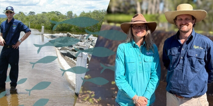
FBA’s Tilapia A4 factsheet
Tilapia A4 factsheet
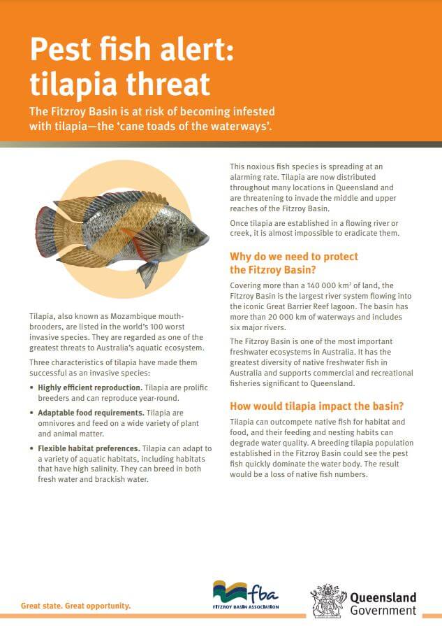
Factsheet on Tilapia (aka Mozambique mouthbrooders) including how to identify them and prevent their spread.
15/07/2019
Brigalow Belt North Fire Management Guidelines
Brigalow Belt North Fire Management Guidelines
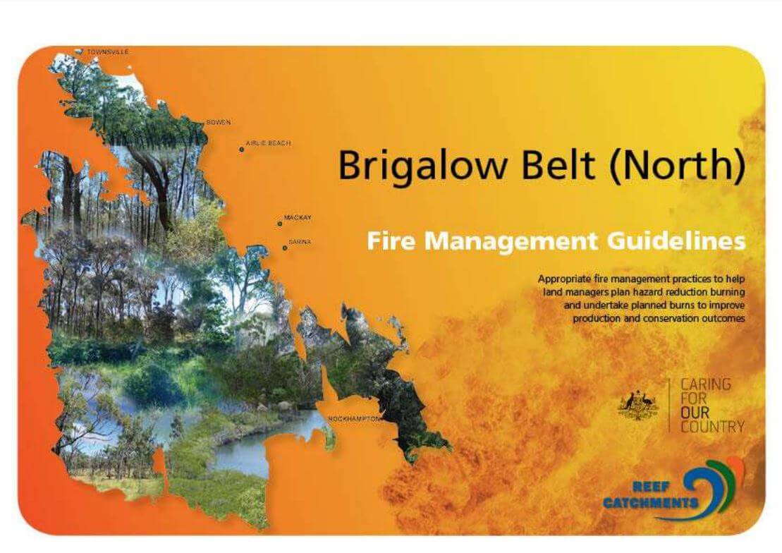
Appropriate fire management practices to help land managers plan hazard reduction burning and undertake planned burns to improve production and conservation outcomes.
15/07/2019
Broader Brigalow Belt South Fire Management Guidelines
Broader Brigalow Belt South Fire Management Guidelines

Appropriate fire management practices to help land managers plan hazard reduction burning and undertake planned burns to improve production and conservation outcomes.
15/07/2019
How to make Stick Rake Lines (Contour Barriers)
How to make Stick Rake Lines (Contour Barriers)
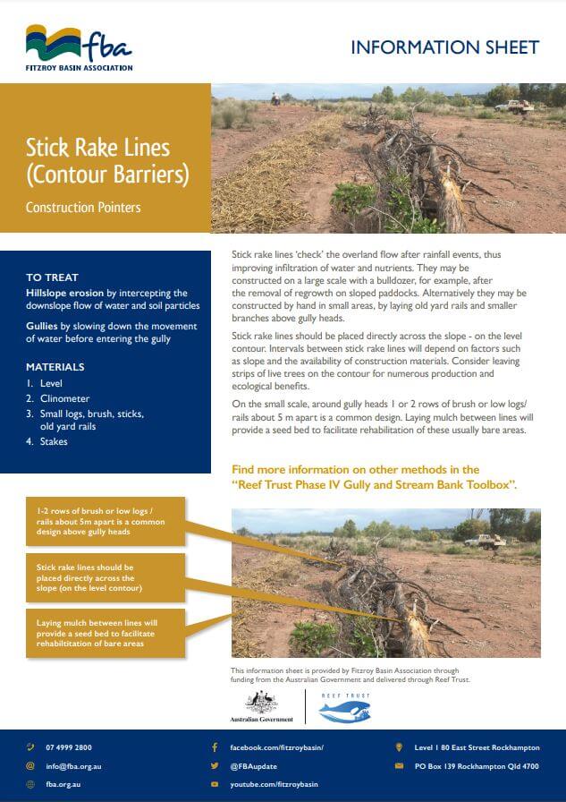
Treat hillslope erosion by intercepting the downslope flow of water and soil particles with Stick Rake Lines (aka Contour Barriers). Create your own Stick Rake Line with this handy construction pointer flyer.
11/07/2019
Porous check dams (leaky weir) educational resources
How to make Porous Check Dams
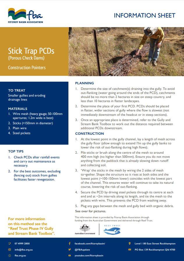
Arresting and reversing gully erosion requires resting the area and taking steps to rebuild and re-vegetate gullies. These resources explain simple and cost-efficient methods to help slow flow and start rebuilding gully floors through building Porous Check Dams (PCDs). PCDs are a low-cost and low-risk erosion control method recommended by CSIRO in their 'Gully Toolbox' kit.
11/07/2019